Symbolic image of geodata in media management with compass, map and digital camera

The importance of geodata in media management

Reading time: 9 Minuten

Table of contents

The production of photos and videos has increased significantly in the digital era. This applies equally to commercial, documentary and private purposes. Many companies are therefore faced with the challenge of having to organize large quantities of image material on a daily basis. DAM systems* were developed precisely for this task. They offer a platform on which digital content can be stored and managed centrally. Descriptive metadata such as image descriptions or keywords play a decisive role here. However, technical metadata is at least as important. This also includes geodata, whose benefits for photo and video management will be discussed in this article.

* DAM stands for digital asset management, the term for the professional management of media files.

What is geodata?

When we talk about geodata or location data, we usually mean information generated by GPS signals.* GPS information includes longitude and latitude as well as altitude in relation to sea level.

GPS signals are not always used exclusively to determine the position when taking photographs or filming. On smartphones in particular, data from Wi-Fi positioning or cell tower triangulation can also be used. Modern cameras and smartphones then automatically save the result of the positioning (coordinates and altitude) in the metadata containers of the files.

* The Global Positioning System is the most widely used satellite-based positioning system. However, there are other, lesser-known satellite systems for determining position.

More than coordinates – a new dimension in media organization

GPS was developed for tracking purposes. At the time, it was not foreseeable that this would one day become a benefit for media management. But today, the integration of geodata into DAM systems creates a whole new media dimension. Photos and videos can now be sorted and structured not only according to traditional criteria such as date, time or content, but also according to their geographical context. We will take a closer look at what this means in the next sections.

3 Use cases for geodata in the DAM area

Viewed objectively, geodata are just numbers that can be used to determine recording locations. And yet this is a source of information that opens up a wide range of possibilities for media management. In the following, we describe three specific applications that result from the integration of geodata into DAM systems.

1. Visual geolocalization

Imagine managing a large image database with photos taken in different regions of the world. If the images are tagged with geo-coordinates, they can be displayed directly on an interactive map.

This visual representation is particularly useful for companies that need to organize their media by geographic region. Typically, these would be stock photo agencies, tour operators, conservation organizations, or real estate companies. Users can then simply select relevant locations or regions on the map and search through the photos and videos taken there.

2. Advanced search functions

One of the most powerful features that geodata enables in the DAM sector is the radius search. Users can perform a search query not only based on classic metadata such as keywords or date ranges, but also based on geographical criteria. For example, users can search for all images taken within a certain radius of a specific location.

This feature is particularly useful when a company needs content in a specific geographic context, such as for local marketing campaigns or to document regional events. Thanks to the precision of GPS-based geodata, the radius search can be very accurate so that only geographically relevant content is returned.

3. Organization and sorting options

The automatic grouping and sorting of media according to where they were taken is another way in which geodata can be used. For example, if a company regularly takes pictures in different locations, the DAM system can automatically sort these images according to their geographical location. This not only saves time in organization, but also ensures that the media is presented in a coherent way.

In addition, geo-tagged media can also be filtered by region. This is particularly useful when large amounts of photos or videos need to be searched or organized.

Geodata in photos (Exif GPS tags)

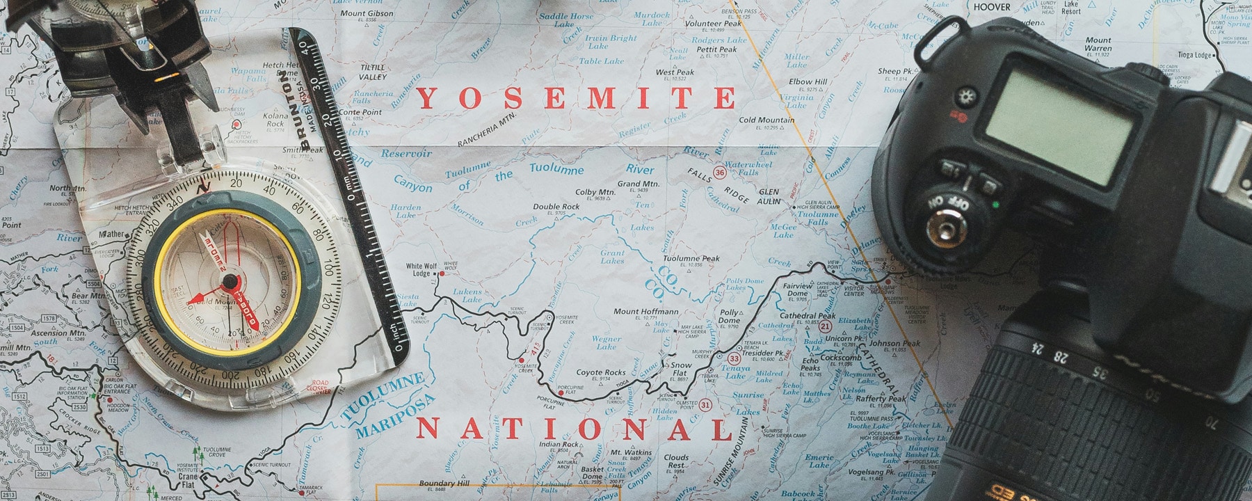
Saving geodata in photo files is common practice. The Exif format developed for digital cameras is usually used for this. The prerequisite is, of course, that the location function has not been deactivated, for example for data protection reasons.

Exif can store a wide range of information about the conditions under which the photo was taken, such as exposure time, aperture, ISO value etc. This also includes geodata, which is stored in a separate section (GPS IFD) within the Exif data structure. These entries are referred to as GPS tags.

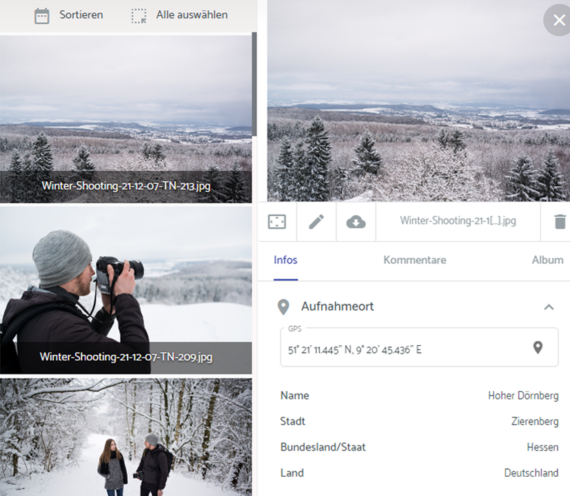
In addition to the coordinates and altitude, time stamps can also be saved via the GPS tags. These are based on the last GPS fix, the time at which the position was last successfully calculated.

Moreover, smartphones and some professional cameras can also record the direction in which the device was pointing when it was triggered. This is done using built-in sensors such as magnetometers and gyroscopes. The corresponding information is referred to as image direction. A complete list of the GPS parameters that can be mapped in Exif format can be viewed here.

Disadvantages and restrictions

When dealing with geodata stored in Exif format, it should be considered that it’s not encrypted and can therefore be easily read or manipulated. There is therefore a risk that sensitive location information could be unintentionally shared with third parties, especially when uploading to platforms or exchanging images.

In addition, the Exif standard is not supported by all image formats. While JPEG, TIFF and HEIF integrate Exif metadata without restrictions, RAW formats do not offer native support and only store it to a limited extent. PNG and WebP also only support Exif data to a very limited extent.

Requirements for geodata in videos

While only a single GPS fix is needed for a photo, it can make sense to save multiple GPS data points throughout the recording time for a video (GPS logging). This is especially relevant for drone or helicopter shots, where the camera moves significantly during a take. The storage of numerous GPS fixes in chronological order naturally places higher demands on the recording software and the video formats used. Advanced container formats such as MP4, MOV or MXF support the continuous recording of GPS data. Outdated formats such as AVI or ASF/WMV, on the other hand, do not offer such options.

Conclusion

GPS data in photos and videos adds an extra dimension to media management. Their integration into DAM systems not only makes the organization of media more efficient and intuitive, but also opens up new possibilities for very different industries and areas of application through visual geolocalization and radius searches. At the same time, companies should know the technical limitations of certain formats. It is also important to be aware of the sensitivity of location data so that it is processed securely and unintentional sharing with third parties is avoided.

Geodata in the Media Hub from teamnext

With the GPS extension module for the teamnext | Media Hub, existing geodata in photos can be automatically read out and displayed in the Media Hub. Subsequent creation of geodata is also possible, including via batch processing. All geodata is indexed so that it can be searched and filtered accordingly.

A particularly practical feature is the radius search, which can be used to display all geo-tagged images taken within a certain radius of a selected location.


When creating geodata manually, you do not need to know any coordinates, but can simply search for the location by entering text (see screenshot). The marker can also be placed at the desired point on the map using drag-and-drop.


When displaying the recording location, not only the coordinates are shown. The tool automatically supplements the entry with superordinate location information such as city, state and country.


Discover the teamnext | Media Hub

Are you interested in the numerous functions of our Media Hub? Then book an appointment for an individual online demo with one of our experts. Subsequently you will have the opportunity to try out the Media Hub for yourself during a free 14-day trial period. For further information, please do not hesitate to contact us personally. You can find our contact details at teamnext.com/en/contact.

You might also be interested in

Header graphic: symbolic image - shortcuts for Windows Explorer with Explorer icon and mini keyboard for Ctrl+C and Ctrl+V
Header graphic: field sizes and camera angles - Astronaut Buzz Aldrin with US flag on the moon, various image sections
Header image with various live moments from sports events, symbol image AI-based content delivery